NMFlood.org
A collaborative resource to promote New Mexico flood risk awareness and resiliency

A collaborative resource to promote New Mexico flood risk awareness and resiliency
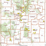
Discovery Project Areas
Base Level Engineering Project Areas
Base Level Engineering Information
New Mexico Community Flooding Database
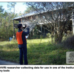
The flooding database is a publicly available database of flooding photographs and videos.
Lidar Building Footprint Toolbar
The LiDAR Building Extraction Toolbox for LiDAR LAS 1.4 files works with ESRI ArcGIS version 10.4, 10.5 and ArcGIS Pro.
New Mexico Debris Flow Story Map & Resources
New Mexico Multi-Hazard Risk Portfolio
Other Statewide Projects
Statewide flood data
Region VI Viewers
CTP Interactive Maps

 https://nmflood.org/wp-content/uploads/2015/05/nmfma.png
144
144
spenman
https://nmflood.org/wp-content/uploads/2018/03/nmflood_logo_expanded.png
spenman2018-12-05 10:11:072018-12-07 15:26:552019 Arid Regions Conference

 https://nmflood.org/wp-content/uploads/2016/01/20160111TADDsigns.png
639
572
Hays Barrett
https://nmflood.org/wp-content/uploads/2018/03/nmflood_logo_expanded.png
Hays Barrett2016-01-11 19:07:392016-01-11 19:07:39149 TADD Signs
https://nmflood.org/wp-content/uploads/2016/01/20160111TADDsigns.png
639
572
Hays Barrett
https://nmflood.org/wp-content/uploads/2018/03/nmflood_logo_expanded.png
Hays Barrett2016-01-11 19:07:392016-01-11 19:07:39149 TADD SignsThe Earth Data Analysis Center, University of New Mexico is the New Mexico Cooperating Technical Partner for FEMA Region VI | Contact
